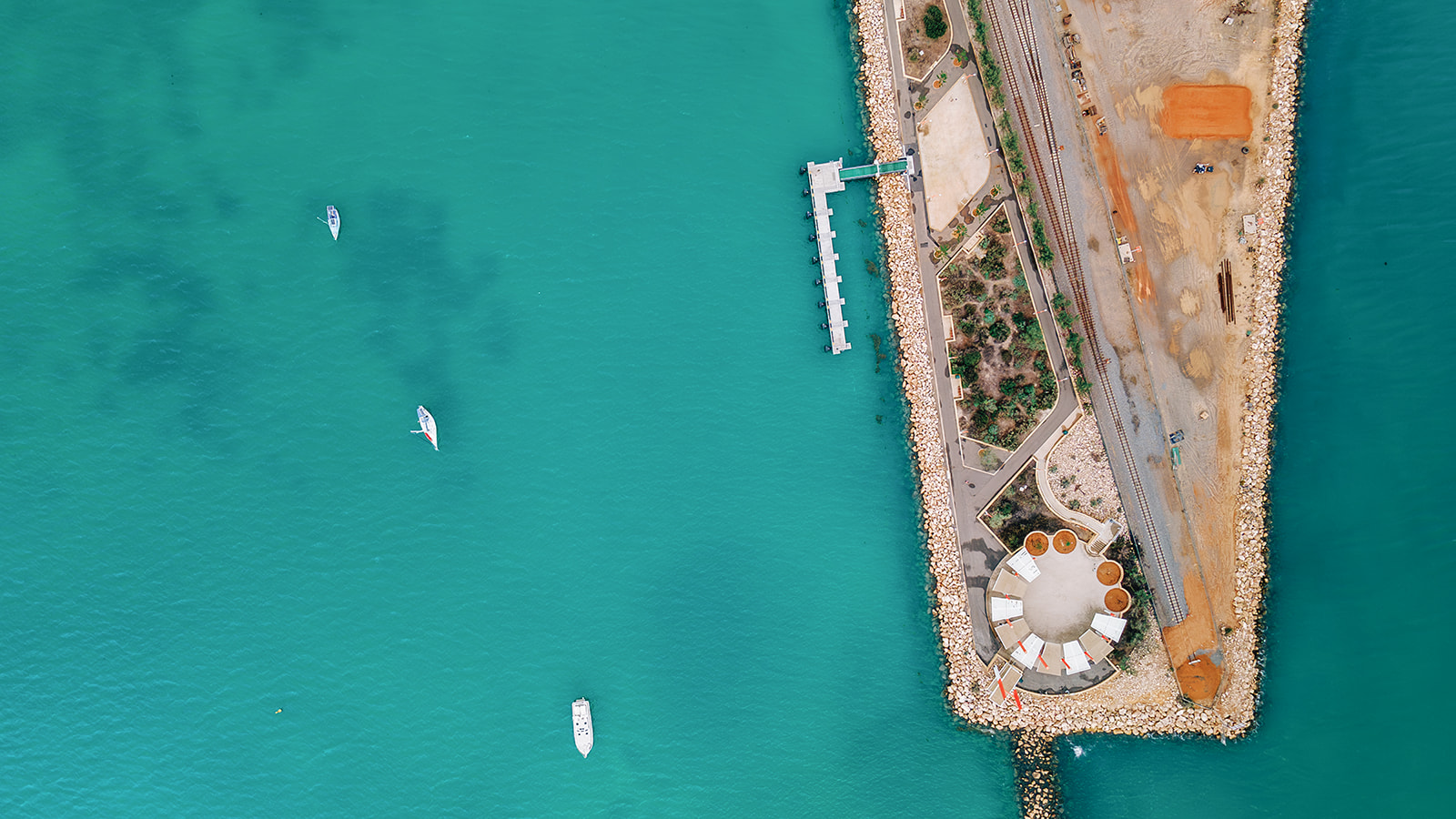
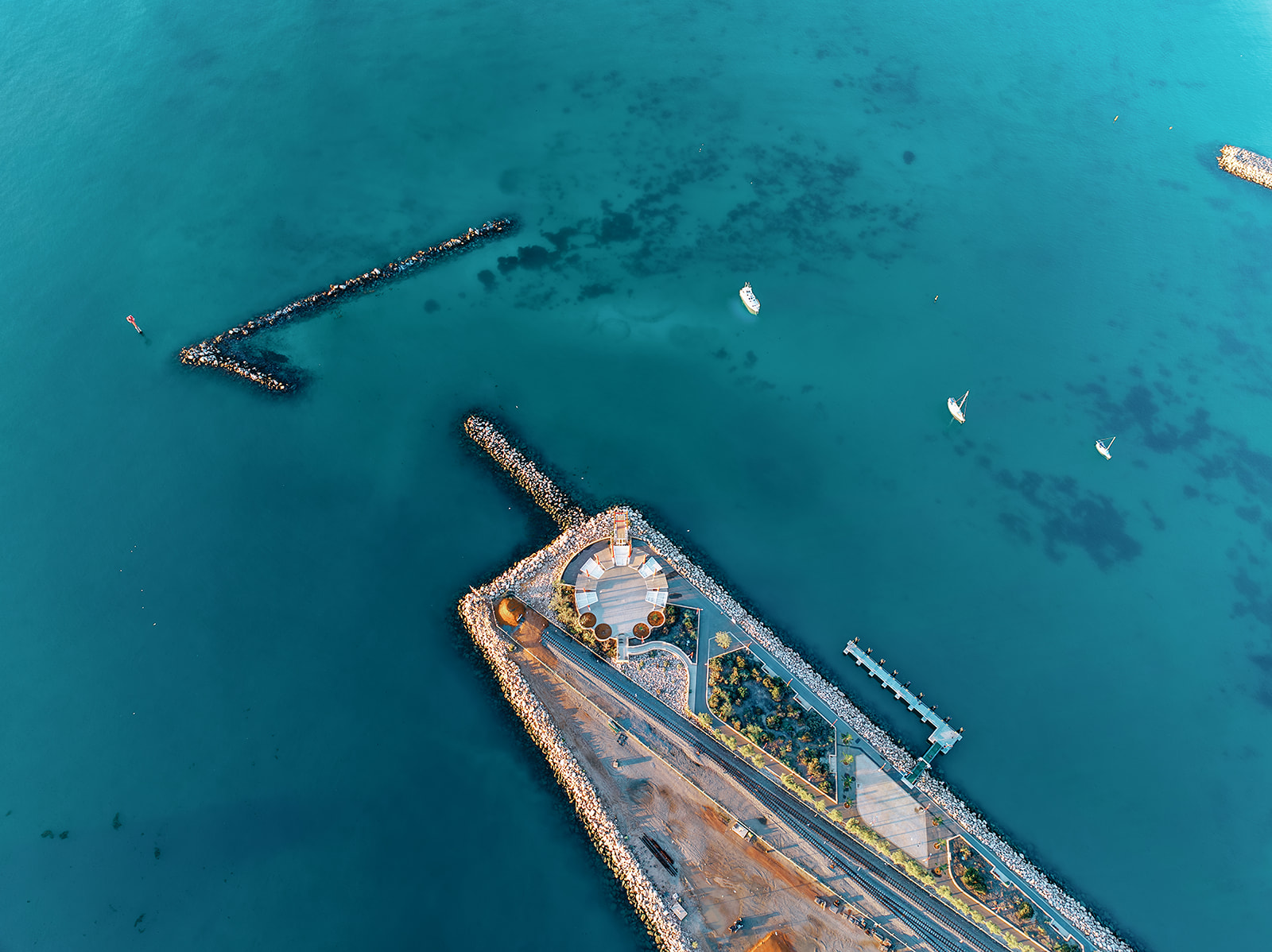
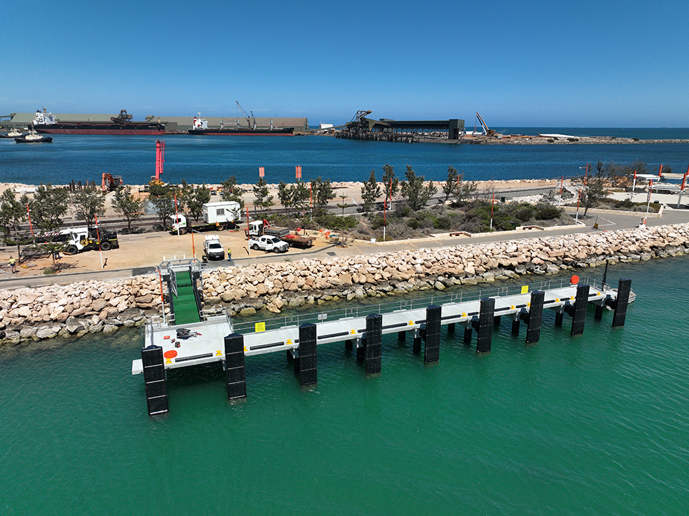
Eastern Breakwater Tourism Jetty
In August 2020, the Minister for Transport appointed Mid West Ports as the lead agency for the delivery of a Geraldton Tourism Jetty to benefit commercial tourism in the region.
The project is being funded as part of the McGowan Government WA COVID-19 Recovery Plan.
The Eastern Breakwater Tourism Jetty was opened by the Premier and Minister for Ports in January 2024.
The Houtman Abrolhos Islands was gazetted as a National Park in July 2019, with the State Government committed to investing in tourism and management infrastructure. The Abrolhos Islands are a unique and pristine location offering an unparalleled marine experience to visitors. Providing quality infrastructure improves visitors' experience and subsequently boosts tourism to the State.
The Eastern Breakwater Jetty leverages the government’s investment in the Abrolhos Islands by supporting increased visitation to the islands directly from Geraldton. The Jetty is a key component in assisting commercial tourism ventures by providing a facility specifically designed for easy boarding and disembarking of passengers from commercial vessels.
In addition to Abrolhos Islands tourism, there are a range of other marine-based recreational and commercial tourism opportunities that can benefit from the development of centrally located jetty infrastructure including fishing, diving, and snorkelling charters, glass bottom boat tours, cray pot pulls, whale watching, aquaculture farm tours, maritime history tours and the like.
Situated on The Esplanade, the location is tourist-friendly and has easy access to the city centre and services on the foreshore.
Jetty Design
A precast plank and beam, pile jetty was constructed midway along the Geraldton Esplanade (Eastern Breakwater). The jetty was designed to accommodate vessels greater than 25m in length.
The Esplanade is a tourist-friendly location with easy access to the city centre and services on the foreshore.
Environmental Impact Assessments and Management Plans
The project was assessed, and no significant impacts to the marine environment were identified. Mid West Ports has developed management plans and commissioned key environmental studies to inform the design, management, and ongoing monitoring of the facility.
Mid West Ports applied for a Native Vegetation Clearing Permit for the permanent removal of a small area of seagrass identified within a proposed approach channel, should it be required in the future.
Environmental Impact Assessment Report
Technical Appendices
Benthic Communities and Habitat Mapping
Sediment Characterisation Report
Seagrass Cumulative Loss Assessment
Native Vegetation Clearing Permit
Native Vegetation Clearing Permit